ᱨᱮᱫ:China Guangdong location map.svg

Page contents not supported in other languages.
ᱣᱤᱠᱤᱯᱤᱰᱤᱭᱟ, ᱨᱟᱲᱟ ᱜᱮᱭᱟᱱ ᱯᱩᱛᱷᱤ ᱠᱷᱚᱱ

ᱟᱥᱚᱞ ᱨᱮᱫ(SVG ᱨᱮᱫ, ᱱᱚᱨᱢᱟᱞᱛᱮ ᱑,᱑᱔᱘ x ᱘᱘᱑ pixels, ᱨᱮᱫ ᱡᱟᱜᱟ: ᱓᱑᱙ KB)

ᱱᱚᱣᱟ ᱨᱮᱫ ᱫᱚ ᱱᱚᱸᱰᱮ ᱠᱷᱚᱱ Wikimedia Commons ᱟᱨ ᱯᱟᱥᱮᱡ ᱮᱴᱟᱜ-ᱟ ᱯᱚᱨᱡᱮᱠᱴ ᱨᱮᱦᱚᱸ ᱵᱮᱵᱦᱟᱨᱚᱜ ᱠᱟᱱᱟ᱾ ᱱᱚᱣᱟ ᱨᱮᱭᱟ ᱯᱟᱥᱱᱟᱣ ᱠᱟᱛᱷᱟ ᱨᱮᱫ ᱯᱟᱥᱱᱟᱣ ᱥᱟᱦᱴᱟ ᱞᱟᱛᱟᱨᱨᱮ ᱮᱢ ᱮᱱᱟ᱾

ᱢᱩᱬᱩᱛ ᱠᱟᱛᱷᱟ

ᱵᱤᱵᱚᱨᱚᱱᱤ
Deutsch: Positionskarte von Guangdong, Volksrepublik China

Quadratische Plattkarte, N-S-Streckung 109 %. Geographische Begrenzung der Karte:

  • N: 25.7° N
  • S: 20.0° N
  • W: 109.4° O
  • O: 117.5° O
English: Location map of Guangdong, People's Republic of China

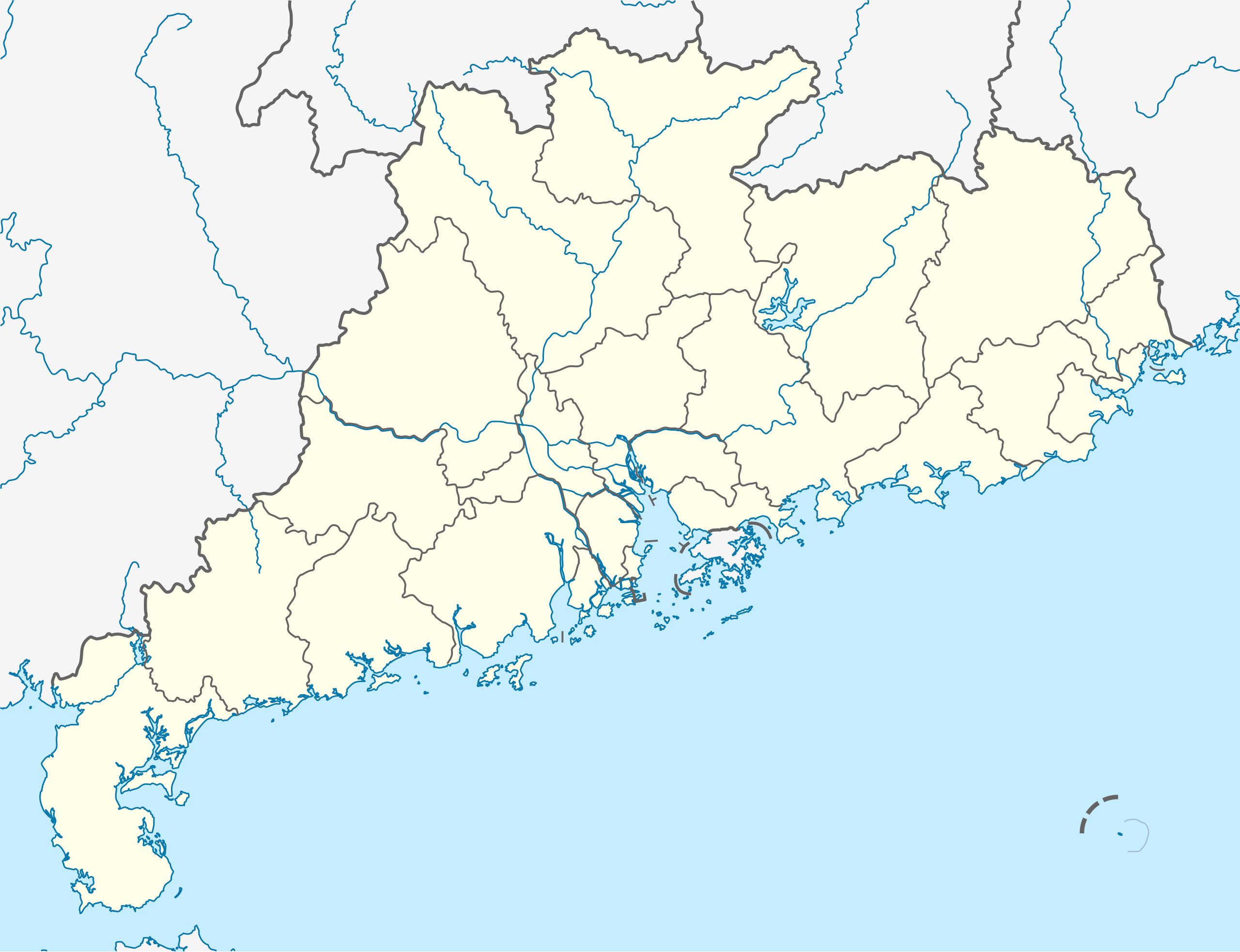
Equirectangular projection, N/S stretching 109 %. Geographic limits of the map:

  • N: 25.7° N
  • S: 20.0° N
  • W: 109.4° E
  • E: 117.5° E
ᱢᱟᱹᱦᱤᱛ
ᱯᱷᱮᱰᱟᱛ

ᱤᱧᱟᱜ ᱠᱟᱹᱢᱤ, using

ᱚᱱᱚᱞᱤᱭᱟᱹ NordNordWest
ᱟᱹᱭᱫᱟᱹᱨᱤ
(ᱱᱚᱣᱟ ᱨᱮᱫ ᱫᱚᱲᱦᱟᱛᱮ ᱵᱮᱵᱷᱟᱨ)

I have published this file as author NordNordWest under the "CC-BY-SA-3.0-DE" in Wikipedia. This means that free, commercial usage outside of Wikipedia is permitted under the following licence terms:

Please send me a specimen copy or the URL of the website where the file is used.

Please write an email to nnwest[at]web.de if you

  • need my postal address for sending a specimen copy
  • have further questions about the terms of the licence

PS: In case of refusal of the above terms the author reserves the right to take legal action.

w:en:Creative Commons
ᱟᱴᱨᱤᱵᱩᱥᱚᱱ ᱦᱟᱹᱴᱤᱧ ᱱᱚᱝᱠᱟ ᱜᱮ
This file is licensed under the Creative Commons Attribution-Share Alike 3.0 Germany license.
ᱟᱲᱟᱜ ᱜᱮᱭᱟᱢ:
  • ᱦᱟᱹᱴᱤᱧᱢᱮ – ᱱᱚᱠᱚᱞ ᱞᱟᱹᱜᱤᱫ, ᱦᱟᱹᱴᱤᱧ ᱟᱨ ᱵᱷᱮᱡᱟᱭᱢᱮ ᱠᱟᱹᱢᱤ
  • ᱢᱮᱥᱟᱣᱠᱟᱛᱢᱮ – ᱠᱟᱹᱢᱤ ᱟᱞᱜᱟᱭ ᱞᱟᱹᱜᱤᱫ
ᱞᱟᱛᱟᱨ ᱨᱮᱭᱟᱜ ᱨᱤᱛ ᱞᱮᱠᱟᱛᱮ:
  • ᱟᱴᱨᱤᱵᱩᱥᱚᱱ – ᱟᱢ ᱠᱟᱹᱢᱤ ᱥᱚᱫᱚᱨ ᱦᱩᱭᱟᱢᱟ ᱡᱚᱠᱷᱚᱱ ᱚᱱᱚᱞᱤᱭᱟᱹ ᱟᱨᱵᱟᱝ ᱞᱟᱭᱥᱮᱸᱥᱩᱭᱟᱹ ᱫᱟᱨᱟᱭᱛᱮ ᱠᱟᱛᱷᱟ ᱨᱟᱠᱟᱵ ᱠᱷᱟᱱ (ᱢᱮᱱᱠᱷᱟᱱ ᱟᱠᱚ ᱩᱫᱩᱜᱟᱜ ᱦᱚᱨ ᱛᱮᱫᱚ ᱵᱟᱝ ᱡᱟᱦᱟᱸ ᱟᱠᱚᱠᱚ ᱜᱚᱲᱚᱣᱟᱢ ᱟᱨᱵᱟᱝ ᱟᱢᱟᱜ ᱠᱟᱹᱢᱤ ᱨᱮᱱᱟᱜ ᱵᱮᱵᱷᱟᱨ)
  • ᱦᱟᱹᱴᱤᱧ ᱱᱚᱝᱠᱟ ᱜᱮ – ᱟᱢ ᱡᱩᱫᱤ ᱠᱟᱹᱢᱤ ᱵᱚᱫᱚᱞ, ᱛᱚᱨᱡᱚᱢᱟ, ᱵᱟᱝᱠᱷᱟᱱ ᱱᱚᱣᱟ ᱠᱟᱹᱢᱤ ᱪᱮᱛᱟᱱᱨᱮ ᱱᱟᱣᱟ ᱠᱟᱹᱢᱤ ᱥᱤᱨᱡᱟᱹᱣᱮᱢ ᱛᱮᱭᱟᱨ ᱠᱷᱟᱱ, ᱛᱚᱵᱮ ᱟᱢ ᱫᱚ ᱚᱱᱟ ᱠᱟᱹᱢᱤ ᱚᱱᱟ ᱢᱤᱫ ᱞᱟᱤᱥᱮᱱᱥ ᱥᱮ ᱚᱱᱟ ᱞᱮᱠᱟᱱᱟᱜ ᱞᱟᱤᱥᱮᱱᱥ ᱨᱮᱜᱮ ᱪᱟᱞ ᱦᱩᱭᱩᱜ ᱛᱟᱢᱟ᱾
Kartenwerkstatt
This map has been made or improved in the German Kartenwerkstatt (Map Lab). You can propose maps to improve as well.

Captions

Add a one-line explanation of what this file represents

Items portrayed in this file

ᱞᱟ.ᱭᱟᱭ

creator ᱟᱝᱜᱽᱨᱮᱡᱤ

some value

author name string ᱟᱝᱜᱽᱨᱮᱡᱤ: NordNordWest
Wikimedia username ᱟᱝᱜᱽᱨᱮᱡᱤ: NordNordWest

copyright status ᱟᱝᱜᱽᱨᱮᱡᱤ

copyrighted ᱟᱝᱜᱽᱨᱮᱡᱤ

copyright license ᱟᱝᱜᱽᱨᱮᱡᱤ

inception ᱟᱝᱜᱽᱨᱮᱡᱤ

᱓᱐ ᱢᱟᱨᱪ 2010

source of file ᱟᱝᱜᱽᱨᱮᱡᱤ

original creation by uploader ᱟᱝᱜᱽᱨᱮᱡᱤ

MIME type ᱟᱝᱜᱽᱨᱮᱡᱤ

image/svg+xml

checksum ᱟᱝᱜᱽᱨᱮᱡᱤ

d666574e5155ec099e354cd8cac9716923fd9d82

determination method ᱟᱝᱜᱽᱨᱮᱡᱤ: SHA-1 ᱟᱝᱜᱽᱨᱮᱡᱤ

data size ᱟᱝᱜᱽᱨᱮᱡᱤ

᱓᱒᱖,᱔᱒᱒ byte

height ᱟᱝᱜᱽᱨᱮᱡᱤ

᱘᱘᱑ pixel

width ᱟᱝᱜᱽᱨᱮᱡᱤ

᱑,᱑᱔᱘ pixel

ᱨᱮᱫ ᱨᱮᱭᱟᱜ ᱱᱟᱜᱟᱢ

ᱚᱠᱛᱚ ᱨᱮ ᱞᱤᱱ ᱢᱮ/ᱚᱠᱛᱚ ᱨᱮ ᱨᱮᱫ ᱧᱮᱞ ᱞᱟᱹᱜᱤᱛ ᱞᱤᱱ ᱢᱮ

ᱢᱟᱹᱦᱤᱛ/ᱚᱠᱛᱚᱴᱤᱯᱡᱚᱠᱷᱟᱵᱮᱵᱷᱟᱨᱤᱭᱟᱹᱠᱟᱛᱷᱟ
ᱱᱤᱛᱚᱜ᱒᱑:᱕᱕, ᱓᱐ ᱢᱟᱨᱪ ᱒᱐᱑᱐᱒᱑:᱕᱕, ᱓᱐ ᱢᱟᱨᱪ ᱒᱐᱑᱐ ᱞᱮᱠᱟᱛᱮ ᱛᱷᱚᱢᱵᱽᱱᱮᱞ ᱵᱷᱚᱨᱥᱚᱱ᱑,᱑᱔᱘ × ᱘᱘᱑ (᱓᱑᱙ KB)NordNordWest=={{int:filedesc}}== {{Information |Description= {{de|Positionskarte von Guangdong, Volksrepublik China}} Quadratische Plattkarte, N-S-Streckung 109 %. Geographische Begrenzung der Karte: * N: 25.7° N * S: 2

ᱞᱟᱛᱟᱨ ᱨᱮᱭᱟᱜ 3 ᱥᱟᱦᱴᱟᱠᱚ ᱡᱚᱱᱚᱲ ᱱᱤᱭᱟᱹ ᱨᱮᱫ ᱨᱮ:

ᱡᱮᱜᱮᱛ ᱡᱟᱠᱟᱛ ᱨᱮᱫ ᱵᱮᱵᱷᱟᱨᱟᱜ

ᱱᱚᱶᱟ ᱨᱮᱫᱠᱚ ᱵᱮᱵᱷᱟᱨᱟᱠᱟᱫ ᱣᱤᱠᱤᱠᱚ :

ᱱᱚᱶᱟ ᱨᱮᱫ ᱨᱮᱱᱟᱜ ᱵᱟᱹᱲᱛᱤ ᱡᱮᱜᱮᱛ ᱵᱮᱵᱷᱟᱨ ᱧᱮᱞ ᱢᱮ ᱾

ᱢᱮᱴᱟ ᱥᱟᱹᱠᱷᱭᱟᱹᱛ