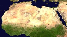
ᱨᱮᱫ:Africa satellite plane.jpg

ᱧᱮᱞᱡᱚᱝ ᱨᱮᱱᱟᱜ ᱟᱠᱟᱨ:᱕᱗᱐ × ᱖᱐᱐ ᱯᱤᱠᱥᱮᱞ ᱮᱴᱟᱜ ᱨᱤᱡᱚᱞᱩᱥᱚᱱᱥ: ᱒᱒᱘ × ᱒᱔᱐ ᱯᱤᱠᱥᱮᱞ | ᱔᱕᱖ × ᱔᱘᱐ ᱯᱤᱠᱥᱮᱞ | ᱗᱓᱐ × ᱗᱖᱘ ᱯᱤᱠᱥᱮᱞ | ᱙᱗᱓ × ᱑,᱐᱒᱔ ᱯᱤᱠᱥᱮᱞ | ᱑,᱙᱔᱗ × ᱒,᱐᱔᱘ ᱯᱤᱠᱥᱮᱞ | ᱘,᱔᱖᱐ × ᱘,᱙᱐᱐ ᱯᱤᱠᱥᱮᱞ
ᱟᱥᱚᱞ ᱨᱮᱫ (᱘,᱔᱖᱐ x ᱘,᱙᱐᱐ pixels, file size: ᱗.᱓᱔ MB, MIME type: image/jpeg)
ᱨᱮᱫ ᱨᱮᱭᱟᱜ ᱱᱟᱜᱟᱢ
ᱚᱠᱛᱚ ᱨᱮ ᱞᱤᱱ ᱢᱮ/ᱚᱠᱛᱚ ᱨᱮ ᱨᱮᱫ ᱧᱮᱞ ᱞᱟᱹᱜᱤᱛ ᱞᱤᱱ ᱢᱮ
| ᱢᱟᱹᱦᱤᱛ/ᱚᱠᱛᱚ | ᱴᱤᱯ | ᱡᱚᱠᱷᱟ | ᱵᱮᱵᱷᱟᱨᱤᱭᱟᱹ | ᱠᱟᱛᱷᱟ | |
|---|---|---|---|---|---|
| ᱱᱤᱛᱚᱜ | ᱐᱐:᱔᱖, ᱒᱘ ᱢᱟᱨᱪ ᱒᱐᱐᱕ |  | ᱘,᱔᱖᱐ × ᱘,᱙᱐᱐ (᱗.᱓᱔ MB) | Dbenbenn | original high-resolution version, cropped land_shallow_topo_west.tif at 8460x8900+19400+6200 |
| ᱒᱑:᱐᱘, ᱑᱓ ᱱᱚᱵᱷᱮᱢᱵᱚᱨ ᱒᱐᱐᱔ |  | ᱗᱔᱑ × ᱘᱐᱐ (᱑᱑᱓ KB) | Bjarki S |
ᱯᱷᱟᱭᱤᱞ ᱵᱮᱣᱦᱟᱨ
ᱞᱟᱛᱟᱨ ᱨᱮᱭᱟᱜ ᱥᱟᱦᱴᱟ ᱡᱚᱱᱚᱲᱠᱚ ᱱᱤᱭᱟᱹ ᱨᱮᱫ ᱨᱮ:
ᱡᱮᱜᱮᱛ ᱡᱟᱠᱟᱛ ᱨᱮᱫ ᱵᱮᱵᱷᱟᱨᱟᱜ
ᱱᱚᱶᱟ ᱨᱮᱫᱠᱚ ᱵᱮᱵᱷᱟᱨᱟᱠᱟᱫ ᱣᱤᱠᱤᱠᱚ :
- ace.wikipedia.org ᱨᱮ ᱵᱮᱣᱦᱟᱨ
- af.wikipedia.org ᱨᱮ ᱵᱮᱣᱦᱟᱨ
- als.wikipedia.org ᱨᱮ ᱵᱮᱣᱦᱟᱨ
- ar.wikipedia.org ᱨᱮ ᱵᱮᱣᱦᱟᱨ
- ar.wikinews.org ᱨᱮ ᱵᱮᱣᱦᱟᱨ
- ast.wikipedia.org ᱨᱮ ᱵᱮᱣᱦᱟᱨ
- azb.wikipedia.org ᱨᱮ ᱵᱮᱣᱦᱟᱨ
- az.wikipedia.org ᱨᱮ ᱵᱮᱣᱦᱟᱨ
- az.wikiquote.org ᱨᱮ ᱵᱮᱣᱦᱟᱨ
- ba.wikipedia.org ᱨᱮ ᱵᱮᱣᱦᱟᱨ
- be.wikipedia.org ᱨᱮ ᱵᱮᱣᱦᱟᱨ
- bm.wikipedia.org ᱨᱮ ᱵᱮᱣᱦᱟᱨ
- ca.wikiquote.org ᱨᱮ ᱵᱮᱣᱦᱟᱨ
- cdo.wikipedia.org ᱨᱮ ᱵᱮᱣᱦᱟᱨ
- co.wikipedia.org ᱨᱮ ᱵᱮᱣᱦᱟᱨ
- cv.wikipedia.org ᱨᱮ ᱵᱮᱣᱦᱟᱨ
- da.wikipedia.org ᱨᱮ ᱵᱮᱣᱦᱟᱨ
- de.wikipedia.org ᱨᱮ ᱵᱮᱣᱦᱟᱨ
- Oldowan
- CFA-Franc-Zone
- Fußball in Südafrika
- Portal:Afrika
- Wikipedia:Archiv/Qualitätsoffensive/Afrika
- Wikipedia:WikiProjekt Afrika
- Wikipedia Diskussion:WikiProjekt Afrika
- Uganda Olympic Committee
- Wikipedia:WikiProjekt Sudan
- Portal:Afrika/Unsere besten Artikel
- Wikipedia:WikiProjekt Äthiopien
- Portal:Gambia
- Fußball in Äthiopien
- Wikipedia:WikiProjekt Sudan/Verwandte
- Portal:Afrika/Register
- Benutzer:Vorlage/Herkunftsvorlagen
- Portal:Hip-Hop
- Portal:Hip-Hop/Hip-Hop nach Ländern
- Namibia National Olympic Committee
- Fußball
- Benutzer:Heiteck
- Benutzer:Vorlage/aus Afrika
- Gambia National Olympic Committee
- Portal:Nigeria
- Fußball in Lesotho
- Fußball in Burkina Faso
ᱱᱚᱶᱟ ᱨᱮᱫ ᱨᱮᱱᱟᱜ ᱵᱟᱹᱲᱛᱤ ᱡᱮᱜᱮᱛ ᱵᱮᱵᱷᱟᱨ ᱧᱮᱞ ᱢᱮ ᱾


