
ᱨᱮᱫ:Austria adm location map.svg

ᱟᱥᱚᱞ ᱨᱮᱫ (SVG ᱨᱮᱫ, ᱱᱚᱨᱢᱟᱞᱛᱮ ᱑,᱒᱕᱖ x ᱗᱐᱐ pixels, ᱨᱮᱫ ᱡᱟᱜᱟ: ᱑᱘᱓ KB)
ᱢᱩᱬᱩᱛ ᱠᱟᱛᱷᱟ
| ᱵᱤᱵᱚᱨᱚᱱᱤ |
Deutsch: Positionskarte von Österreich
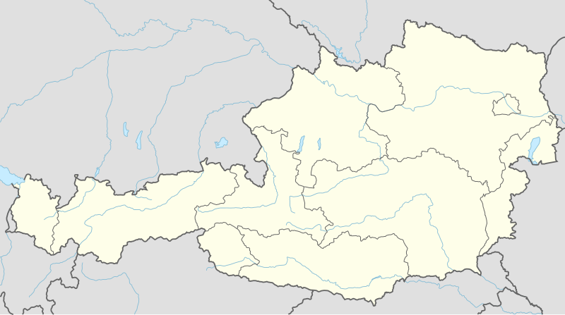
English: Location map of Austria
|
||||||||||||
| ᱢᱟᱹᱦᱤᱛ | |||||||||||||
| ᱯᱷᱮᱰᱟᱛ |
Own work using:
|
||||||||||||
| ᱚᱱᱚᱞᱤᱭᱟᱹ | NordNordWest | ||||||||||||
| SVG genesis |
|
||||||||||||

ᱞᱟᱭᱥᱮᱱᱥ ᱛᱮᱭᱟᱨ
Usage of this file with:

explanatory notes: Legally binding is only the full legalcode. For a free usage I recommend to respect the following licence conditions:
1. Provide my name as given above: NordNordWest,
2. a copy of, or the URI for, the applicable license: https://creativecommons.org/licenses/by-sa/3.0/de/legalcode,
3. the title of the work,
4. in the case of an adaptation, a credit identifying the use of the work in the adaptation.
This license and the rights granted hereunder will terminate automatically upon any breach by you of the terms of this license. Any of the above conditions can be waived if you get permission from the copyright holder. If you have questions or wish differing conditions, please contact me through nnwest or my discussion page ![]() t-online.de
t-online.de
- ᱟᱲᱟᱜ ᱜᱮᱭᱟᱢ:
- ᱦᱟᱹᱴᱤᱧᱢᱮ – ᱱᱚᱠᱚᱞ ᱞᱟᱹᱜᱤᱫ, ᱦᱟᱹᱴᱤᱧ ᱟᱨ ᱵᱷᱮᱡᱟᱭᱢᱮ ᱠᱟᱹᱢᱤ
- ᱢᱮᱥᱟᱣᱠᱟᱛᱢᱮ – ᱠᱟᱹᱢᱤ ᱟᱞᱜᱟᱭ ᱞᱟᱹᱜᱤᱫ
- ᱞᱟᱛᱟᱨ ᱨᱮᱭᱟᱜ ᱨᱤᱛ ᱞᱮᱠᱟᱛᱮ:
- ᱟᱴᱨᱤᱵᱩᱥᱚᱱ – ᱟᱢ ᱠᱟᱹᱢᱤ ᱥᱚᱫᱚᱨ ᱦᱩᱭᱟᱢᱟ ᱡᱚᱠᱷᱚᱱ ᱚᱱᱚᱞᱤᱭᱟᱹ ᱟᱨᱵᱟᱝ ᱞᱟᱭᱥᱮᱸᱥᱩᱭᱟᱹ ᱫᱟᱨᱟᱭᱛᱮ ᱠᱟᱛᱷᱟ ᱨᱟᱠᱟᱵ ᱠᱷᱟᱱ (ᱢᱮᱱᱠᱷᱟᱱ ᱟᱠᱚ ᱩᱫᱩᱜᱟᱜ ᱦᱚᱨ ᱛᱮᱫᱚ ᱵᱟᱝ ᱡᱟᱦᱟᱸ ᱟᱠᱚᱠᱚ ᱜᱚᱲᱚᱣᱟᱢ ᱟᱨᱵᱟᱝ ᱟᱢᱟᱜ ᱠᱟᱹᱢᱤ ᱨᱮᱱᱟᱜ ᱵᱮᱵᱷᱟᱨ)
- ᱦᱟᱹᱴᱤᱧ ᱱᱚᱝᱠᱟ ᱜᱮ – ᱟᱢ ᱡᱩᱫᱤ ᱠᱟᱹᱢᱤ ᱵᱚᱫᱚᱞ, ᱛᱚᱨᱡᱚᱢᱟ, ᱵᱟᱝᱠᱷᱟᱱ ᱱᱚᱣᱟ ᱠᱟᱹᱢᱤ ᱪᱮᱛᱟᱱᱨᱮ ᱱᱟᱣᱟ ᱠᱟᱹᱢᱤ ᱥᱤᱨᱡᱟᱹᱣᱮᱢ ᱛᱮᱭᱟᱨ ᱠᱷᱟᱱ, ᱛᱚᱵᱮ ᱟᱢ ᱫᱚ ᱚᱱᱟ ᱠᱟᱹᱢᱤ ᱚᱱᱟ ᱢᱤᱫ ᱞᱟᱤᱥᱮᱱᱥ ᱥᱮ ᱚᱱᱟ ᱞᱮᱠᱟᱱᱟᱜ ᱞᱟᱤᱥᱮᱱᱥ ᱨᱮᱜᱮ ᱪᱟᱞ ᱦᱩᱭᱩᱜ ᱛᱟᱢᱟ᱾

ᱨᱮᱫ ᱨᱮᱭᱟᱜ ᱱᱟᱜᱟᱢ
ᱚᱠᱛᱚ ᱨᱮ ᱞᱤᱱ ᱢᱮ/ᱚᱠᱛᱚ ᱨᱮ ᱨᱮᱫ ᱧᱮᱞ ᱞᱟᱹᱜᱤᱛ ᱞᱤᱱ ᱢᱮ
| ᱢᱟᱹᱦᱤᱛ/ᱚᱠᱛᱚ | ᱴᱤᱯ | ᱡᱚᱠᱷᱟ | ᱵᱮᱵᱷᱟᱨᱤᱭᱟᱹ | ᱠᱟᱛᱷᱟ | |
|---|---|---|---|---|---|
| ᱱᱤᱛᱚᱜ | ᱑᱙:᱐᱒, ᱒ ᱰᱤᱥᱮᱢᱵᱚᱨ ᱒᱐᱑᱔ | | ᱑,᱒᱕᱖ × ᱗᱐᱐ (᱑᱘᱓ KB) | NordNordWest | == {{int:filedesc}} == {{Information |Description= {{de|1=Positionskarte von Österreich}} {{en|1=Location map of Austria}} {{Location map series N |stretching=150 |top=49.2 |bottom=46.3 |left=9.4 |right=17.2 }} |Source={{Own using}} * United States Na... |
ᱯᱷᱟᱭᱤᱞ ᱵᱮᱣᱦᱟᱨ
ᱞᱟᱛᱟᱨ ᱨᱮᱭᱟᱜ 2 ᱥᱟᱦᱴᱟᱠᱚ ᱡᱚᱱᱚᱲ ᱱᱤᱭᱟᱹ ᱨᱮᱫ ᱨᱮ:
ᱡᱮᱜᱮᱛ ᱡᱟᱠᱟᱛ ᱨᱮᱫ ᱵᱮᱵᱷᱟᱨᱟᱜ
ᱱᱚᱶᱟ ᱨᱮᱫᱠᱚ ᱵᱮᱵᱷᱟᱨᱟᱠᱟᱫ ᱣᱤᱠᱤᱠᱚ :
- ab.wikipedia.org ᱨᱮ ᱵᱮᱣᱦᱟᱨ
- ast.wikipedia.org ᱨᱮ ᱵᱮᱣᱦᱟᱨ
- Amstetten
- Viena
- Minihof-Liebau
- Burgruine Starhemberg
- Burgruine Aggstein
- Castiellu d'Ambras
- Donnerskirchen
- Selva de Bohemia
- Salzburgu
- Fugging
- Graz
- Innsbruck
- Linz
- Patrimoniu de la Humanidá n'Austria
- Palaciu Belvedere
- Estadiu Ernst Happel
- Universidá de Viena
- Universidá d'Economía de Viena
- Circuitu d'Österreichring
- Eisenstadt
- Klagenfurt
- Sankt Pölten
- Bregenz
- Módulu:Mapa de llocalización/datos/Austria
- Leibnitz
- Módulu:Mapa de llocalización/datos/Austria/usu
- Fraxern
- Bañu central de Viena
- Berg und Löwenherz
- Aeropuertu de Graz
- Aeropuertu d'Innsbruck
- Aeropuertu de Klagenfurt
- Aeropuertu de Linz
- Catedral de San Esteban de Viena
- Ferrocarril de Mariazell
- as.wikipedia.org ᱨᱮ ᱵᱮᱣᱦᱟᱨ
- azb.wikipedia.org ᱨᱮ ᱵᱮᱣᱦᱟᱨ
- ban.wikipedia.org ᱨᱮ ᱵᱮᱣᱦᱟᱨ
- bh.wikipedia.org ᱨᱮ ᱵᱮᱣᱦᱟᱨ
- bn.wikipedia.org ᱨᱮ ᱵᱮᱣᱦᱟᱨ
ᱱᱚᱶᱟ ᱨᱮᱫ ᱨᱮᱱᱟᱜ ᱵᱟᱹᱲᱛᱤ ᱡᱮᱜᱮᱛ ᱵᱮᱵᱷᱟᱨ ᱧᱮᱞ ᱢᱮ ᱾