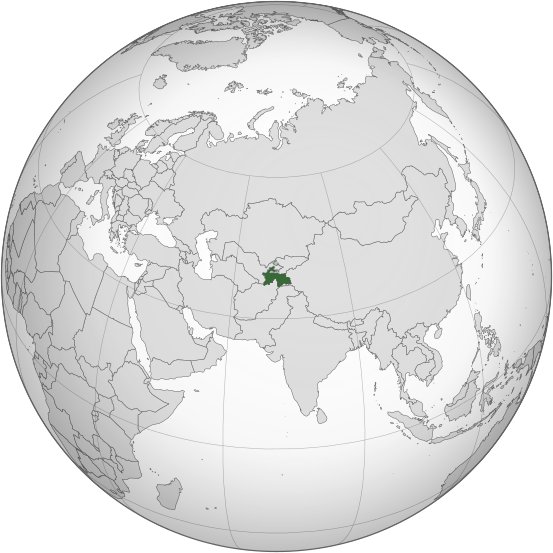
ᱨᱮᱫ:Tajikistan (orthographic projection).svg

Size of this PNG preview of this SVG file: ᱕᱕᱓ × ᱕᱕᱓ ᱯᱤᱠᱥᱮᱞ. ᱮᱴᱟᱜ ᱨᱤᱡᱚᱞᱩᱥᱚᱱᱥ: ᱒᱔᱐ × ᱒᱔᱐ ᱯᱤᱠᱥᱮᱞ | ᱔᱘᱐ × ᱔᱘᱐ ᱯᱤᱠᱥᱮᱞ | ᱗᱖᱘ × ᱗᱖᱘ ᱯᱤᱠᱥᱮᱞ | ᱑,᱐᱒᱔ × ᱑,᱐᱒᱔ ᱯᱤᱠᱥᱮᱞ | ᱒,᱐᱔᱘ × ᱒,᱐᱔᱘ ᱯᱤᱠᱥᱮᱞ
ᱟᱥᱚᱞ ᱨᱮᱫ (SVG ᱨᱮᱫ, ᱱᱚᱨᱢᱟᱞᱛᱮ ᱕᱕᱓ x ᱕᱕᱓ pixels, ᱨᱮᱫ ᱡᱟᱜᱟ: ᱓᱐᱔ KB)
ᱨᱮᱫ ᱨᱮᱭᱟᱜ ᱱᱟᱜᱟᱢ
ᱚᱠᱛᱚ ᱨᱮ ᱞᱤᱱ ᱢᱮ/ᱚᱠᱛᱚ ᱨᱮ ᱨᱮᱫ ᱧᱮᱞ ᱞᱟᱹᱜᱤᱛ ᱞᱤᱱ ᱢᱮ
| ᱢᱟᱹᱦᱤᱛ/ᱚᱠᱛᱚ | ᱴᱤᱯ | ᱡᱚᱠᱷᱟ | ᱵᱮᱵᱷᱟᱨᱤᱭᱟᱹ | ᱠᱟᱛᱷᱟ | |
|---|---|---|---|---|---|
| ᱱᱤᱛᱚᱜ | ᱒᱓:᱔᱑, ᱑᱖ ᱢᱟᱨᱪ ᱒᱐᱑᱕ |  | ᱕᱕᱓ × ᱕᱕᱓ (᱓᱐᱔ KB) | Flappiefh | Removed Somaliland and Kosovo. Separated Western Sahara and Morroco. |
| ᱑᱖:᱓᱙, ᱔ ᱚᱜᱚᱥᱴ ᱒᱐᱑᱓ |  | ᱕᱕᱓ × ᱕᱕᱓ (᱓᱐᱘ KB) | Flappiefh | Added South Sudan. The map is now centered on Tadjikistan. | |
| ᱐᱙:᱒᱑, ᱑᱖ ᱢᱮ ᱒᱐᱑᱑ |  | ᱕᱕᱐ × ᱕᱕᱐ (᱔᱘᱕ KB) | Eddo | graphic design? | |
| ᱑᱖:᱒᱔, ᱒᱓ ᱡᱟᱱᱩᱣᱟᱨᱤ ᱒᱐᱑᱑ |  | ᱑᱐᱗ × ᱑᱐᱗ (᱗᱙ KB) | RaviC | {{Information |Description={{en|Location of Tajikistan. Taken from [http://www.un.org/Depts/Cartographic/map/profile/tajikist.pdf UN Map]<br/> en:Category:Maps of Tajikistan}} |Source=Transferred from [http://en.wikipedia.org en.wikipedia]; transf |
ᱯᱷᱟᱭᱤᱞ ᱵᱮᱣᱦᱟᱨ
ᱞᱟᱛᱟᱨ ᱨᱮᱭᱟᱜ 2 ᱥᱟᱦᱴᱟᱠᱚ ᱡᱚᱱᱚᱲ ᱱᱤᱭᱟᱹ ᱨᱮᱫ ᱨᱮ:
ᱡᱮᱜᱮᱛ ᱡᱟᱠᱟᱛ ᱨᱮᱫ ᱵᱮᱵᱷᱟᱨᱟᱜ
ᱱᱚᱶᱟ ᱨᱮᱫᱠᱚ ᱵᱮᱵᱷᱟᱨᱟᱠᱟᱫ ᱣᱤᱠᱤᱠᱚ :
- ace.wikipedia.org ᱨᱮ ᱵᱮᱣᱦᱟᱨ
- ady.wikipedia.org ᱨᱮ ᱵᱮᱣᱦᱟᱨ
- af.wikipedia.org ᱨᱮ ᱵᱮᱣᱦᱟᱨ
- als.wikipedia.org ᱨᱮ ᱵᱮᱣᱦᱟᱨ
- ami.wikipedia.org ᱨᱮ ᱵᱮᱣᱦᱟᱨ
- ar.wikipedia.org ᱨᱮ ᱵᱮᱣᱦᱟᱨ
- طاجيكستان
- بوابة:العالم الإسلامي/دولة مختارة/أرشيف
- بوابة:العالم الإسلامي/دولة مختارة/29
- بوابة:طاجيكستان
- بوابة:طاجيكستان/واجهة
- قائمة الدول ذات السيادة والأقاليم التابعة في آسيا
- معاملة المثليين في طاجيكستان
- العلاقات الأمريكية الطاجيكية
- العلاقات الأنغولية الطاجيكستانية
- العلاقات الطاجيكستانية الكورية الجنوبية
- العلاقات الإريترية الطاجيكستانية
- العلاقات السويسرية الطاجيكستانية
- العلاقات الألمانية الطاجيكستانية
- العلاقات الطاجيكستانية الليختنشتانية
- العلاقات البوليفية الطاجيكستانية
- العلاقات الطاجيكستانية الموزمبيقية
- العلاقات الألبانية الطاجيكستانية
- العلاقات البلجيكية الطاجيكستانية
- العلاقات الإثيوبية الطاجيكستانية
- العلاقات البيلاروسية الطاجيكستانية
- العلاقات الروسية الطاجيكية
- العلاقات الرومانية الطاجيكستانية
- العلاقات الأرجنتينية الطاجيكستانية
- العلاقات الطاجيكستانية الغامبية
- العلاقات الطاجيكستانية القبرصية
- العلاقات السيراليونية الطاجيكستانية
- العلاقات الطاجيكستانية النيبالية
- العلاقات الطاجيكستانية الليبيرية
- العلاقات التشيكية الطاجيكستانية
- العلاقات الطاجيكستانية الميانمارية
- العلاقات الطاجيكستانية الكندية
- العلاقات الزيمبابوية الطاجيكستانية
- العلاقات الإسرائيلية الطاجيكستانية
- العلاقات البالاوية الطاجيكستانية
- العلاقات الطاجيكستانية المالية
- العلاقات الطاجيكستانية النيجيرية
- العلاقات اليمنية الطاجيكستانية
- العلاقات الطاجيكستانية الفانواتية
- العلاقات الغابونية الطاجيكستانية
- العلاقات البنمية الطاجيكستانية
- العلاقات الطاجيكستانية الكوبية
- العلاقات الجورجية الطاجيكستانية
- العلاقات التونسية الطاجيكستانية
- العلاقات الطاجيكستانية الكورية الشمالية
- العلاقات الهندية الطاجيكية
ᱱᱚᱶᱟ ᱨᱮᱫ ᱨᱮᱱᱟᱜ ᱵᱟᱹᱲᱛᱤ ᱡᱮᱜᱮᱛ ᱵᱮᱵᱷᱟᱨ ᱧᱮᱞ ᱢᱮ ᱾

