
ᱠᱷᱟᱭᱨᱟᱪᱟᱛᱟᱨ
This article needs additional citations for verification. (September 2014) (Learn how and when to remove this template message) |
| ᱠᱷᱟᱭᱨᱟᱪᱟᱛᱟᱨ | |
|---|---|
| ᱥᱚᱦᱚᱨ | |
 | |
 ᱠᱷᱟᱭᱨᱟᱪᱟᱛᱟᱨ  ᱠᱷᱟᱭᱨᱟᱪᱟᱛᱟᱨ | |
| Coordinates: 23°32′21″N 85°55′58″E / 23.53917°N 85.93278°ECoordinates: 23°32′21″N 85°55′58″E / 23.53917°N 85.93278°E | |
| Country | |
| State | Jharkhand |
| District | Bokaro |
| ᱩᱥᱩᱞ | 400 ᱢᱤᱴᱚᱨ (1300 ᱯᱷᱩᱴ) |
| ᱞᱮᱠᱷᱟ ᱡᱚᱠᱷᱟ ᱥᱮᱨᱢᱟ | (᱒᱐᱑᱑) |
| • ᱞᱮᱠᱷᱟᱜᱩᱴ | ᱒᱓᱖᱓ |
| IST (ᱭᱩᱴᱤᱥᱤ+5:30) | |
| ᱜᱟᱹᱰᱤ ᱨᱤᱡᱤᱥᱴᱨᱤ | JH |
ᱠᱷᱚᱭᱨᱟᱪᱟᱛᱟᱨ ᱫᱚ ᱥᱤᱧᱚᱛ ᱫᱤᱥᱚᱢ ᱯᱚᱱᱚᱛ ᱡᱷᱟᱨᱠᱷᱚᱸᱰ ᱨᱮ ᱵᱚᱠᱟᱨᱚ ᱦᱚᱱᱚᱛ ᱨᱮᱱᱟᱜ ᱢᱤᱫ ᱦᱩᱰᱤᱝ ᱥᱚᱦᱚᱨ ᱟᱨ ᱢᱤᱫ ᱜᱽᱨᱟᱢ ᱯᱚᱧᱪᱟᱭᱚᱛ ᱠᱟᱱᱟ ᱾
Geography
[ᱥᱟᱯᱲᱟᱣ | ᱯᱷᱮᱰᱟᱛ ᱥᱟᱯᱲᱟᱣ]Economy
[ᱥᱟᱯᱲᱟᱣ | ᱯᱷᱮᱰᱟᱛ ᱥᱟᱯᱲᱟᱣ]Transportation
[ᱥᱟᱯᱲᱟᱣ | ᱯᱷᱮᱰᱟᱛ ᱥᱟᱯᱲᱟᱣ]ᱥᱮᱪᱮᱫ
[ᱥᱟᱯᱲᱟᱣ | ᱯᱷᱮᱰᱟᱛ ᱥᱟᱯᱲᱟᱣ]ᱠᱷᱚᱭᱨᱟᱪᱟᱛᱟᱨ ᱨᱮ ᱥᱮᱪᱮᱫ ᱟᱥᱲᱟ ᱠᱚ:
- ᱠᱷᱚᱭᱨᱟᱪᱟᱛᱟᱨ ᱠᱚᱞᱮᱡᱽ
- ᱢᱮᱰᱤᱞ ᱟᱥᱲᱟ, ᱠᱷᱚᱭᱨᱟᱪᱟᱛᱟᱨ
ᱨᱚᱱᱵᱤᱡᱚᱭ ᱨᱳᱥᱚᱱ ᱯᱚᱵᱞᱤᱠ ᱥᱠᱩᱞ: ᱢᱤᱫ ᱠᱚᱢᱮᱰᱤᱠᱟᱞ ᱤᱝᱞᱤᱥ ᱢᱤᱰᱤᱭᱟᱢ ᱯᱚᱵᱞᱤᱠ ᱥᱠᱩᱞ ᱠᱤᱰᱥ ᱜᱟᱨᱰᱮᱱ ᱯᱚᱵᱞᱤᱠ ᱥᱠᱩᱞ ᱥᱤᱥᱩ ᱢᱚᱱᱫᱤᱨ ᱟᱱᱚᱱᱫᱽ ᱢᱟᱨᱜᱽ ᱟᱥᱲᱟ
- ᱥᱟᱨᱠᱥ ᱥᱮᱪᱮᱫ ᱛᱟᱞᱢᱟ
ᱥᱟᱬᱮᱥ ᱥᱮᱪᱮᱫ ᱥᱟᱨᱠᱟᱞ (SSC)
ᱦᱚᱲ ᱮᱞᱠᱷᱟ
[ᱥᱟᱯᱲᱟᱣ | ᱯᱷᱮᱰᱟᱛ ᱥᱟᱯᱲᱟᱣ]
ᱜᱽᱞᱮᱨᱤ
[ᱥᱟᱯᱲᱟᱣ | ᱯᱷᱮᱰᱟᱛ ᱥᱟᱯᱲᱟᱣ]-
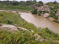 Viddaha River
 -
 Shepherds at the bank of the river Viddaha
 -
 Gateway to Sewati Hills
 -
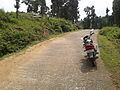 Heesim Hills
 -
 Picturesque Heesim Hills
 -
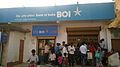 Bank of India Khairachatar


ᱥᱟᱹᱠᱷᱭᱟᱹᱛ
[ᱥᱟᱯᱲᱟᱣ | ᱯᱷᱮᱰᱟᱛ ᱥᱟᱯᱲᱟᱣ]ᱛᱷᱚᱠᱠᱩ:
- Pages with script errors
- Pages with non-numeric formatnum arguments
- Orphaned articles from September 2014
- Articles with invalid date parameter in template
- All orphaned articles
- Articles needing additional references from September 2014
- All articles needing additional references
- Wikipedia page with obscure country or subdivision
- Coordinates on Wikidata
- Bokaro district