ᱥᱨᱤᱞᱚᱝᱠᱟ ᱨᱮᱱᱟᱜ ᱥᱟᱥᱚᱱᱤᱭᱟᱹ ᱴᱚᱴᱷᱟ ᱠᱚ
 | ᱱᱚᱶᱟ ᱚᱱᱚᱞ ᱫᱚ ᱣᱤᱠᱤᱯᱤᱰᱤᱭᱟ ᱮᱥᱤᱭᱳ ᱪᱟᱸᱫᱚ ᱒᱐᱒᱐ ᱨᱮ ᱥᱟᱯᱲᱟᱣ ᱠᱟᱱᱟ ᱾ |
| ᱥᱨᱤᱞᱚᱝᱠᱟ ᱨᱮᱱᱟᱜ ᱥᱟᱥᱚᱱᱤᱭᱟᱹ ᱴᱚᱴᱷᱟ ᱠᱚ | |||||||||||||
|---|---|---|---|---|---|---|---|---|---|---|---|---|---|
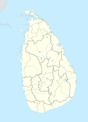 ᱥᱨᱤᱞᱚᱝᱠᱟ ᱨᱮᱱᱟᱜ ᱥᱟᱥᱚᱱᱤᱭᱟᱹ ᱢᱮᱯ | |||||||||||||
| ᱴᱷᱟᱹᱶ | ᱥᱨᱤᱞᱚᱝᱠᱟ | ||||||||||||
| ᱦᱟᱹᱴᱤᱧ |
| ||||||||||||
ᱥᱨᱤᱞᱚᱝᱠᱟ ᱙ ᱜᱚᱴᱟᱱ ᱥᱟᱥᱚᱱᱤᱭᱟᱹ ᱴᱚᱴᱷᱟ ᱨᱮ ᱦᱟᱹᱴᱤᱧ ᱢᱮᱱᱟᱜᱼᱟ, ᱱᱚᱶᱟ ᱠᱚ ᱟᱨᱦᱚᱸ ᱒᱕ ᱜᱚᱴᱟᱱ ᱦᱚᱱᱚᱛ ᱨᱮ ᱦᱟᱹᱴᱤᱧᱟ ᱾ ᱦᱚᱱᱚᱛ ᱟᱨᱦᱚᱸ ᱢᱤᱭᱩᱱᱤᱥᱤᱯᱟᱞᱤᱴᱤ ᱨᱮ ᱦᱟᱹᱴᱤᱧ ᱟᱠᱟᱱᱟ, ᱡᱟᱦᱟᱸ ᱫᱚ ᱯᱮᱭᱟ ᱛᱷᱚᱠ ᱨᱮ ᱦᱟᱹᱴᱤᱧ ᱜᱟᱱᱚᱜᱼᱟ ᱾ ᱥᱟᱱᱟᱢ ᱢᱤᱭᱩᱱᱤᱥᱤᱯᱟᱞᱤᱴᱤ ᱣᱟᱨᱰ ᱨᱮ ᱟᱨ ᱣᱟᱨᱰ ᱠᱚ ᱜᱽᱨᱟᱢ ᱱᱤᱞᱟᱫᱷᱟᱨᱤ ᱠᱷᱚᱸᱰ ᱨᱮ ᱦᱟᱹᱴᱤᱧ ᱢᱮᱱᱟᱜᱼᱟ ᱾
ᱱᱟᱜᱟᱢ
[ᱥᱟᱯᱲᱟᱣ | ᱯᱷᱮᱰᱟᱛ ᱥᱟᱯᱲᱟᱣ]ᱯᱳᱭᱞᱳ ᱚᱱᱩᱨᱟᱫᱷᱟᱯᱩᱨᱟ ᱨᱟᱡᱽ ᱚᱠᱛᱚ ᱨᱮ ᱥᱨᱤᱞᱚᱝᱠᱟ ᱟᱭᱢᱟ ᱜᱟᱱ ᱥᱟᱥᱚᱱᱤᱭᱟᱹ ᱴᱚᱴᱷᱟ ᱨᱮ ᱦᱟᱹᱴᱤᱧ ᱛᱟᱦᱮ ᱠᱟᱱᱟ ᱾ ᱨᱟᱡᱽ ᱫᱚ ᱢᱩᱬᱩᱛ ᱯᱮᱭᱟ ᱯᱨᱚᱫᱮᱥ ᱨᱮ ᱦᱟᱹᱴᱤᱧ ᱛᱟᱦᱮ ᱠᱟᱱᱟ, ᱢᱮᱞᱟᱠᱟ : ᱨᱟᱡᱟᱨᱟᱛᱟ, ᱨᱩᱦᱟᱱᱟ ᱟᱨ ᱢᱟᱞᱟᱭᱟ ᱨᱟᱛᱟ ᱾ ᱱᱚᱶᱟ ᱠᱚ ᱟᱨᱦᱚᱸ ᱦᱩᱰᱤᱝ ᱛᱷᱚᱠ ᱨᱮ ᱦᱟᱹᱴᱤᱧ ᱛᱟᱦᱮ ᱠᱟᱱᱟ, ᱡᱟᱦᱟᱸ ᱫᱚ ᱨᱟᱛᱟ ᱠᱚ ᱢᱮᱛᱟᱜ ᱠᱟᱱᱟ[᱑] ᱾ ᱚᱠᱛᱚ ᱯᱟᱨᱚᱢ ᱪᱟᱞᱟᱣ ᱥᱟᱶ ᱥᱟᱶ ᱛᱮ ᱯᱨᱚᱫᱮᱥ ᱠᱚ ᱨᱮᱱᱟᱜ ᱮᱞᱠᱷᱟ ᱰᱷᱮᱨ ᱪᱟᱞᱟᱣ ᱟᱠᱟᱱᱟ, ᱢᱮᱱᱠᱷᱟᱱ ᱫᱚᱥᱟᱨ ᱛᱷᱚᱠ ᱨᱮᱱᱟᱜ ᱥᱟᱥᱚᱱᱤᱭᱟᱹ ᱦᱟᱹᱴᱤᱧ ᱠᱚ ᱫᱚ ᱨᱟᱛᱟ ᱢᱮᱱᱛᱮ ᱜᱮ ᱵᱟᱲᱟᱭᱚᱜ ᱠᱟᱱ ᱛᱟᱦᱮᱱᱟ ᱾ ᱛᱟᱭᱚᱢ ᱛᱮ ᱫᱤᱥᱚᱢ ᱟᱭᱢᱟ ᱜᱟᱱ ᱨᱟᱡᱽ ᱨᱮ ᱦᱟᱹᱴᱤᱧ ᱟᱨ ᱵᱟᱨᱦᱮ ᱫᱤᱥᱚᱢ (ᱵᱤᱫᱮᱥᱤ) ᱨᱟᱡᱽ ᱠᱚ ᱦᱮᱡ ᱟᱨ ᱫᱤᱥᱚᱢ ᱨᱮᱱᱟᱜ ᱟᱫᱚᱢ ᱴᱚᱴᱷᱟ ᱟᱠᱚᱣᱟᱜ ᱪᱟᱪᱞᱟᱣ (control) ᱨᱮ ᱟᱹᱜᱩ ᱛᱟᱭᱚᱢ ᱱᱚᱶᱟ ᱵᱮᱵᱚᱥᱛᱟ ᱵᱚᱫᱚᱞ ᱤᱫᱤᱣᱟᱠᱟᱱᱟ ᱾
᱑᱕᱐᱕ ᱥᱮᱨᱢᱟ ᱨᱮ ᱯᱳᱨᱛᱩᱜᱤᱡᱽ ᱦᱮᱡ ᱛᱟᱭᱚᱢ ᱡᱚᱠᱷᱚᱱ ᱱᱚᱶᱟ ᱫᱤᱥᱚᱢ ᱨᱮᱱᱟᱜ ᱛᱷᱚᱨᱟ ᱜᱟᱱ ᱴᱚᱴᱷᱟ ᱠᱚ ᱫᱚᱠᱷᱚᱞ ᱞᱮᱫᱼᱟ[᱒], ᱩᱱᱠᱩ ᱥᱨᱤᱞᱚᱝᱠᱟ ᱨᱮᱱ ᱥᱟᱥᱚᱱᱤᱭᱟᱹ ᱠᱚᱣᱟᱜ ᱥᱟᱥᱚᱱᱤᱭᱟᱹ ᱵᱮᱵᱚᱥᱛᱟ ᱠᱚ ᱟᱨᱦᱚᱸ ᱠᱚ ᱦᱩᱰᱤᱝ ᱞᱮᱫᱼᱟ[᱓] ᱾ ᱫᱤᱥᱚᱢ ᱨᱮ ᱰᱟᱪ ᱥᱟᱥᱚᱱ ᱚᱠᱛᱚ, ᱩᱱᱠᱩᱣᱟᱜ ᱪᱟᱪᱞᱟᱣ ᱨᱮ ᱛᱟᱦᱮᱠᱟᱱ ᱴᱚᱴᱷᱟ ᱠᱚ ᱯᱮᱭᱟ ᱥᱟᱥᱚᱱᱤᱭᱟᱹ ᱦᱟᱹᱴᱤᱧ ᱨᱮ ᱦᱟᱹᱴᱤᱧ ᱦᱩᱭ ᱞᱮᱱᱟ ᱾ ᱚᱱᱟᱠᱚ ᱞᱟᱦᱟᱛᱮᱱᱟᱜ ᱵᱮᱵᱚᱥᱛᱟ ᱞᱮᱠᱟᱜᱮ ᱰᱤᱵᱷᱟᱥᱟ ᱠᱚ ᱨᱮ ᱦᱟᱹᱴᱤᱧ ᱦᱩᱭ ᱞᱮᱱᱟ[᱔] ᱾ ᱵᱨᱤᱴᱤᱥ ᱯᱳᱭᱞᱳ ᱱᱚᱶᱟ ᱵᱮᱵᱚᱥᱛᱟ ᱜᱮᱠᱚ ᱞᱟᱦᱟ ᱤᱫᱤ ᱞᱮᱫᱟ[᱕], ᱢᱮᱱᱠᱷᱟᱱ ᱑᱗᱙᱖ ᱠᱷᱚᱱ ᱑᱘᱐᱒ ᱥᱮᱨᱢᱟ ᱨᱮ ᱥᱩᱫᱷᱨᱟᱹᱣ ᱛᱟᱭᱚᱢ, ᱡᱟᱹᱛᱤ ᱜᱷᱟᱨᱚᱸᱡᱽ ᱞᱮᱠᱟᱛᱮ ᱫᱤᱥᱚᱢ ᱦᱟᱹᱴᱤᱧ ᱛᱟᱦᱮ ᱠᱟᱱᱟ[᱖][᱗] ᱾
᱑᱙᱕᱕ ᱥᱮᱨᱢᱟ ᱨᱮ ᱫᱤᱥᱚᱢ ᱨᱮᱱᱟᱜ ᱢᱩᱬᱩᱛ ᱥᱟᱥᱚᱱᱤᱭᱟᱹ ᱛᱷᱚᱠ ᱞᱮᱠᱟᱛᱮ ᱦᱚᱱᱚᱛ ᱵᱚᱫᱚᱞ ᱛᱮ ᱯᱨᱚᱫᱮᱥ ᱛᱷᱟᱯᱚᱱ ᱦᱩᱭ ᱟᱠᱟᱱᱟ[᱘] ᱾ ᱢᱤᱫ ᱱᱟᱶᱟ ᱥᱚᱝᱵᱤᱫᱷᱟᱱ ᱦᱚᱛᱮᱛᱮ ᱟᱢᱯᱟᱨᱟ ᱦᱚᱱᱚᱛ ᱑᱙᱖᱑ ᱥᱮᱨᱢᱟ ᱨᱮᱱᱟᱜ ᱮᱯᱨᱤᱞ ᱪᱟᱸᱫᱚ ᱨᱮ ᱵᱮᱱᱟᱣ ᱦᱩᱭ ᱟᱠᱟᱱᱟ[᱙][᱑᱐], ᱱᱚᱶᱟ ᱞᱮᱠᱟᱜᱮ ᱑᱙᱗᱘ ᱥᱮᱨᱢᱟ ᱨᱮᱱᱟᱜ ᱥᱮᱯᱴᱮᱢᱵᱚᱨ ᱪᱟᱸᱫᱚ ᱨᱮ ᱢᱩᱞᱞᱟᱭᱛᱤᱵᱷᱤ ᱦᱚᱱᱚᱛ ᱟᱨ ᱜᱟᱢᱯᱟᱦᱟ ᱦᱚᱱᱚᱛ ᱵᱮᱱᱟᱣ ᱦᱩᱭ ᱞᱮᱱᱟ[᱑᱑], ᱡᱟᱦᱟᱸ ᱫᱚ ᱯᱨᱚᱫᱮᱥ ᱢᱩᱬᱩᱛ ᱥᱟᱥᱚᱱᱤᱭᱟᱹ ᱛᱷᱚᱠ ᱞᱮᱠᱟᱛᱮ ᱫᱚᱦᱚᱨᱟᱭ ᱪᱟᱹᱞᱩ ᱟᱠᱟᱫᱟ[᱑᱒] ᱾ ᱥᱟᱱᱟᱢ ᱠᱷᱚᱱ ᱢᱩᱪᱟᱹᱫ ᱨᱮ ᱵᱮᱱᱟᱣ ᱦᱩᱭ ᱟᱠᱟᱱ ᱦᱚᱱᱚᱛ ᱫᱚ ᱠᱤᱞᱤᱱᱳᱪᱪᱤ ᱦᱚᱱᱚᱛ ᱑᱙᱘᱔ ᱥᱮᱨᱢᱟ ᱨᱮᱱᱟᱜ ᱯᱷᱮᱵᱨᱩᱭᱟᱨᱤ ᱪᱟᱸᱫᱚ ᱨᱮ[᱑᱓], ᱟᱨ ᱢᱮᱱᱟᱜ ᱥᱚᱝᱵᱤᱫᱷᱟᱱ (᱑᱙᱗᱘ ᱨᱮ ᱵᱮᱱᱟᱣ ᱟᱠᱟᱱ) ᱞᱮᱠᱟᱛᱮ ᱥᱨᱤᱞᱚᱝᱠᱟ ᱒᱕ ᱜᱚᱴᱟᱱ ᱥᱟᱥᱚᱱᱤᱭᱟᱹ ᱦᱚᱱᱚᱛ ᱤᱫᱤ ᱠᱟᱛᱮᱡ ᱵᱮᱱᱟᱣ ᱢᱮᱱᱟᱜᱼᱟ ᱾ ᱥᱨᱤᱞᱚᱝᱠᱟ ᱥᱚᱝᱥᱚᱫ ᱨᱮᱱᱟᱜ ᱢᱤᱫ ᱫᱷᱟᱨᱟ ᱞᱮᱠᱟᱛᱮ ᱦᱚᱱᱚᱛ ᱠᱚ ᱦᱟᱹᱴᱤᱧ ᱥᱮ ᱢᱤᱫ ᱜᱟᱱᱚᱜᱼᱟ[᱑᱔] ᱾
ᱯᱨᱚᱫᱮᱥ ᱠᱚ
[ᱥᱟᱯᱲᱟᱣ | ᱯᱷᱮᱰᱟᱛ ᱥᱟᱯᱲᱟᱣ]ᱯᱨᱚᱫᱮᱥ ᱥᱨᱤᱞᱚᱝᱠᱟ ᱨᱮᱱᱟᱜ ᱯᱳᱭᱞᱳ ᱛᱷᱚᱠ ᱨᱮᱱᱟᱜ ᱥᱟᱥᱚᱱᱤᱭᱟᱹ ᱦᱟᱹᱴᱤᱧ ᱠᱟᱱᱟ ᱾
| ᱢᱮᱯ | ᱠᱳᱰ | ᱧᱩᱛᱩᱢ | ᱮᱨᱤᱭᱟ (km²) |
ᱦᱚᱲ ᱮᱞ[᱑᱕] | ᱣᱮᱵᱽᱥᱟᱭᱤᱴ |
|---|---|---|---|---|---|

| |||||
| CP | ᱛᱟᱞᱢᱟ ᱯᱨᱚᱫᱮᱥ | ᱕,᱖᱗᱔ | ᱒,᱕᱕᱖,᱗᱗᱔ | cp.gov.lk | |
| EP | ᱥᱟᱢᱟᱝ ᱯᱨᱚᱫᱮᱥ | ᱙,᱙᱙᱖ | ᱑,᱕᱔᱗,᱓᱗᱗ | ep.gov.lk | |
| NC | ᱮᱛᱟᱢ ᱛᱟᱞᱢᱟ ᱯᱨᱚᱫᱮᱥ | ᱑᱐,᱗᱑᱔ | ᱑,᱒᱕᱙,᱔᱒᱑ | nc.gov.lk | |
| NP | ᱮᱛᱚᱢ ᱯᱨᱚᱫᱮᱥ | ᱘,᱘᱘᱔ | ᱑,᱐᱖᱐,᱐᱒᱓ | np.gov.lk | |
| NW | ᱮᱛᱚᱢ ᱯᱟᱪᱮᱭᱟᱭ ᱯᱨᱚᱫᱮᱥ | ᱗,᱘᱑᱒ | ᱒,᱓᱗᱒,᱑᱘᱕ | nw.gov.lk | |
| SG | ᱥᱟᱵᱟᱨᱟᱜᱟᱢᱩᱣᱟ | ᱔,᱙᱐᱒ | ᱑,᱙᱑᱙,᱔᱗᱘ | sg.gov.lk | |
| SP | ᱠᱚᱧᱮᱭᱟᱭ ᱯᱨᱚᱫᱮᱥ | ᱕,᱕᱕᱙ | ᱒,᱔᱖᱕,᱖᱒᱖ | sp.gov.lk | |
| UP | ᱩᱵᱷᱟ | ᱘,᱔᱘᱘ | ᱑,᱒᱕᱙,᱔᱑᱙ | up.gov.lk | |
| WP | ᱯᱟᱪᱮᱭᱟᱭ ᱯᱨᱚᱫᱮᱥ | ᱓,᱗᱐᱙ | ᱕,᱘᱓᱗,᱒᱙᱔ | wpc.gov.lk |
ᱦᱚᱱᱚᱛ ᱠᱚ
[ᱥᱟᱯᱲᱟᱣ | ᱯᱷᱮᱰᱟᱛ ᱥᱟᱯᱲᱟᱣ]ᱦᱚᱱᱚᱛ ᱥᱨᱤᱞᱚᱝᱠᱟ ᱨᱮᱱᱟᱜ ᱫᱚᱥᱟᱨ ᱛᱷᱚᱠ ᱨᱮᱱᱟᱜ ᱥᱟᱥᱚᱱᱤᱭᱟᱹ ᱦᱟᱹᱴᱤᱧ ᱠᱟᱱᱟ ᱾

| ᱦᱚᱱᱚᱛ | ᱢᱮᱯ ᱨᱮ ᱴᱷᱟᱹᱶ | ᱯᱨᱚᱫᱮᱥ | ᱦᱚᱱᱚᱛ ᱨᱟᱡᱽᱜᱟᱲ |
ᱚᱛ ᱦᱟᱥᱟ in km2 (mi2)[᱑᱖] |
ᱤᱱᱞᱮᱱᱰ ᱫᱟᱜ ᱮᱨᱤᱭᱟ in km2 (mi2)[᱑᱖] |
ᱡᱚᱛᱚ ᱮᱨᱤᱭᱟ in km2 (mi2)[᱑᱖] |
ᱦᱚᱲᱮᱞ (᱒᱐᱑᱒)[᱑᱗] |
ᱦᱚᱲᱮᱞ ᱰᱮᱱᱥᱤᱴᱤ per km2 (per mi2)[lower-alpha ᱑] |
|---|---|---|---|---|---|---|---|---|
| ᱟᱢᱯᱟᱨᱟ | 
|
ᱥᱟᱢᱟᱝ | ᱟᱢᱯᱟᱨᱟ | 4,222 (1,630) | 193 (75) | 4,415 (1,705) | 649,402 | 154 (400) |
| ᱚᱱᱩᱨᱟᱫᱷᱟᱯᱩᱨᱟ | 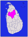
|
ᱮᱛᱚᱢ ᱛᱟᱞᱢᱟ | ᱚᱱᱩᱨᱟᱫᱷᱟᱯᱩᱨᱟ | 6,664 (2,573) | 515 (199) | 7,179 (2,772) | 860,575 | 129 (330) |
| ᱵᱟᱫᱩᱞᱞᱟ | 
|
ᱩᱵᱷᱟ | ᱵᱟᱫᱩᱞᱞᱟ | 2,827 (1,092) | 34 (13) | 2,861 (1,105) | 815,405 | 288 (750) |
| ᱵᱟᱴᱴᱤᱠᱟᱞᱳᱣᱟ | 
|
ᱥᱟᱢᱟᱝ | ᱵᱟᱴᱴᱤᱠᱟᱞᱳᱣᱟ | 2,610 (1,010) | 244 (94) | 2,854 (1,102) | 526,567 | 202 (520) |
| ᱠᱚᱞᱟᱢᱵᱚ | 
|
ᱯᱟᱪᱮᱭᱟᱭ | ᱠᱚᱞᱚᱢᱵᱚ | 676 (261) | 23 (8.9) | 699 (270) | 2,324,349 | 3,438 (8,900) |
| ᱜᱟᱞᱮ | 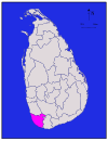
|
ᱠᱚᱧᱮᱭᱟᱭ | ᱜᱟᱞᱮ | 1,617 (624) | 35 (14) | 1,652 (638) | 1,063,334 | 658 (1,700) |
| ᱜᱟᱢᱯᱟᱦᱟ | 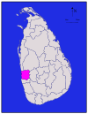
|
ᱯᱟᱪᱮᱭᱟᱭ | ᱜᱟᱢᱯᱟᱦᱟ | 1,341 (518) | 46 (18) | 1,387 (536) | 2,304,833 | 1,719 (4,450) |
| ᱦᱟᱢᱵᱟᱱᱴᱳᱴᱟ | 
|
ᱠᱚᱧᱮᱭᱟᱭ | ᱦᱟᱢᱵᱟᱱᱴᱳᱴᱟ | 2,496 (964) | 113 (44) | 2,609 (1,007) | 599,903 | 240 (620) |
| ᱡᱟᱯᱷᱱᱟ | 
|
ᱮᱛᱚᱢ ᱯᱨᱚᱫᱮᱥ | ᱡᱟᱯᱷᱱᱟ | 929 (359) | 96 (37) | 1,025 (396) | 583,882 | 629 (1,630) |
| ᱠᱟᱞᱩᱛᱟᱨᱟ | 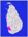
|
ᱯᱟᱪᱮᱭᱟᱭ | ᱠᱟᱞᱩᱛᱟᱨᱟ | 1,576 (608) | 22 (8.5) | 1,598 (617) | 1,221,948 | 775 (2,010) |
| ᱠᱮᱱᱰᱤ | 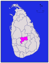
|
ᱛᱟᱞᱢᱟ | ᱠᱮᱱᱰᱤ | 1,917 (740) | 23 (8.9) | 1,940 (750) | 1,375,382 | 716 (1,850) |
| ᱠᱮᱜᱟᱞᱮ | 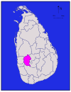
|
ᱥᱟᱵᱟᱨᱟᱜᱟᱢᱩᱣᱟ | ᱠᱮᱜᱟᱞᱮ | 1,685 (651) | 8 (3.1) | 1,693 (654) | 840,648 | 499 (1,290) |
| ᱠᱤᱞᱤᱱᱳᱪᱪᱤ | 
|
ᱮᱛᱚᱢ | ᱠᱤᱞᱤᱱᱳᱪᱪᱤ | 1,205 (465) | 74 (29) | 1,279 (494) | 113,510 | 94 (240) |
| ᱠᱩᱨᱩᱱᱮᱜᱟᱞᱟ | 
|
ᱮᱛᱚᱢ ᱯᱟᱪᱮᱭᱟᱭ | ᱠᱩᱨᱩᱱᱮᱜᱟᱞᱟ | 4,624 (1,785) | 192 (74) | 4,816 (1,859) | 1,618,465 | 350 (910) |
| ᱢᱟᱱᱱᱟᱨ | 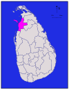
|
ᱮᱛᱚᱢ | ᱢᱟᱱᱱᱟᱨ | 1,880 (730) | 116 (45) | 1,996 (771) | 99,570 | 53 (140) |
| ᱢᱟᱛᱮᱞᱮ | 
|
ᱛᱟᱞᱢᱟ | ᱢᱟᱛᱮᱞᱮ | 1,952 (754) | 41 (16) | 1,993 (770) | 484,531 | 248 (640) |
| ᱢᱟᱛᱟᱨᱟ | 
|
ᱠᱚᱧᱮᱭᱟᱭ | ᱢᱟᱛᱟᱨᱟ | 1,270 (490) | 13 (5.0) | 1,283 (495) | 814,048 | 641 (1,660) |
| ᱢᱳᱱᱟᱨᱟᱜᱟᱞᱟ | 
|
ᱩᱵᱷᱟ | ᱢᱳᱱᱟᱨᱟᱜᱟᱞᱟ | 5,508 (2,127) | 131 (51) | 5,639 (2,177) | 451,058 | 82 (210) |
| ᱢᱩᱞᱞᱟᱭᱛᱤᱵᱷᱤ | 
|
ᱮᱛᱚᱢ | ᱢᱩᱞᱞᱟᱭᱛᱤᱵᱷᱤ | 2,415 (932) | 202 (78) | 2,617 (1,010) | 92,238 | 38 (98) |
| ᱱᱩᱣᱟᱨᱟ ᱮᱞᱤᱭᱟ | 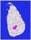
|
ᱛᱟᱢᱟᱞ | ᱱᱩᱣᱟᱨᱟ ᱮᱞᱤᱭᱟ | 1,706 (659) | 35 (14) | 1,741 (672) | 711,644 | 417 (1,080) |
| ᱯᱳᱞᱳᱱᱱᱟᱨᱩᱣᱟ | 
|
ᱮᱛᱚᱢ ᱛᱟᱞᱢᱟ | ᱯᱳᱞᱳᱱᱱᱟᱨᱩᱣᱟ | 3,077 (1,188) | 216 (83) | 3,293 (1,271) | 406,088 | 132 (340) |
| ᱯᱩᱴᱴᱟᱞᱟᱢ | 
|
ᱮᱛᱟᱢ ᱯᱟᱪᱮᱭᱟᱭ | ᱯᱩᱴᱴᱟᱞᱟᱢ | 2,882 (1,113) | 190 (73) | 3,072 (1,186) | 762,396 | 265 (690) |
| ᱨᱟᱛᱱᱟᱯᱩᱨᱟ | 
|
ᱥᱟᱵᱟᱨᱟᱜᱟᱢᱩᱣᱟ | ᱨᱟᱛᱱᱟᱯᱩᱨᱟ | 3,236 (1,249) | 39 (15) | 3,275 (1,264) | 1,088,007 | 336 (870) |
| ᱛᱨᱤᱱᱠᱳᱢᱟᱞᱤ | 
|
ᱥᱟᱢᱟᱝ | ᱛᱨᱤᱱᱠᱳᱢᱟᱞᱤ | 2,529 (976) | 198 (76) | 2,727 (1,053) | 379,541 | 150 (390) |
| ᱵᱷᱟᱵᱷᱩᱱᱤᱭᱟ | 
|
ᱮᱛᱚᱢ | ᱵᱷᱟᱵᱷᱩᱱᱤᱭᱟ | 1,861 (719) | 106 (41) | 1,967 (759) | 172,115 | 92 (240) |
| ᱥᱟᱱᱟᱢ ᱨᱮ | 62,705 (24,211) | 2,905 (1,122) | 65,610 (25,330) | 20,359,439 | 325 (840) |
ᱧᱮᱞ ᱨᱩᱣᱟᱹᱨ
[ᱥᱟᱯᱲᱟᱣ | ᱯᱷᱮᱰᱟᱛ ᱥᱟᱯᱲᱟᱣ]| ᱛᱷᱚᱠ | ᱜᱽᱨᱩᱯ | ᱞᱮᱠᱟᱱ | ᱮᱞ. |
|---|---|---|---|
| ᱑ | ᱯᱨᱚᱫᱮᱥ ᱠᱚ පළාත மாகாணம் |
N/A | ᱙ |
| ᱒ | ᱦᱚᱱᱚᱛ ᱠᱚ දිස්ත්රික්ක மாவட்டம் |
N/A | ᱒᱕ |
| ᱓ | ᱢᱤᱭᱩᱱᱤᱥᱤᱯᱟᱞᱤᱴᱤ ᱠᱚ | ᱥᱚᱦᱚᱨ ᱠᱚ | ᱒᱓ |
| ᱟᱨᱵᱟᱱ ᱥᱚᱦᱚᱨ ᱠᱚ | ᱔᱑ | ||
| Suburban cities | ᱒᱗᱑ | ||
| ᱔ | ᱣᱟᱨᱰ ᱠᱚ | N/A | ? |
| ᱕ | ᱜᱽᱨᱟᱢ ᱱᱤᱞᱟᱫᱷᱟᱨᱤ ᱠᱷᱚᱸᱰ | N/A | ᱑᱔,᱐᱒᱒ |
ᱟᱨᱦᱚᱸ ᱧᱮᱞ ᱢᱮ
[ᱥᱟᱯᱲᱟᱣ | ᱯᱷᱮᱰᱟᱛ ᱥᱟᱯᱲᱟᱣ]ᱵᱟᱨᱦᱮ ᱡᱚᱱᱚᱲ
[ᱥᱟᱯᱲᱟᱣ | ᱯᱷᱮᱰᱟᱛ ᱥᱟᱯᱲᱟᱣ]- "Provinces of Sri Lanka". Statoids.
ᱥᱟᱹᱠᱷᱭᱟᱹᱛ
[ᱥᱟᱯᱲᱟᱣ | ᱯᱷᱮᱰᱟᱛ ᱥᱟᱯᱲᱟᱣ]- ↑ Siriweera 2004, p. 91.
- ↑ Hewavissenti, Panchamee (3 February 2008). "Episodes of colonised history". Sunday Observer (Sri Lanka). Archived from the original on 7 February 2008. Retrieved 21 July 2009.
- ↑ Yogasundaram 2006, p. 168.
- ↑ Yogasundaram 2006, p. 195.
- ↑ Yogasundaram 2006, p. 214.
- ↑ Yogasundaram 2006, p. 258.
- ↑ Peebles 2006, p. 48.
- ↑ Peebles 2006, p. 110.
- ↑ "Overview". Ampara District Secretariat. Archived from the original on 2013-12-24. Retrieved 2016-06-20.
- ↑ Mohideen, M. I. M. (27 December 2007). "Sinhalisation of East: A reply to Minister Champika Ranawaka". The Island (Sri Lanka).
- ↑ "Population by sex and district, census years" (PDF). Statistical Abstract 2011. Department of Census & Statistics, Sri Lanka. Archived from the original (PDF) on 2012-11-13.
- ↑ Schmiegelow, Michèle (1997). Democracy in Asia. Palgrave Macmillan. p. 425. ISBN 0-312-16495-5.
- ↑ Karalliyadda, S. B. (9 June 2013). "Awakening Jaffna Uthuru Wasanthaya". The Nation (Sri Lanka). Archived from the original on 2013-12-24.
- ↑ "Chapter 1: The People, The State and Sovereignty". The Constitution of Sri Lanka. Government of Sri Lanka. Archived from the original on 31 May 2014. Retrieved 21 July 2009.
- ↑ "Population of Sri Lanka by district" (PDF). Department of Census and Statistics. Archived from the original (PDF) on 6 December 2013. Retrieved 28 September 2013.
- ↑ ᱑᱖.᱐ ᱑᱖.᱑ ᱑᱖.᱒ "Table 1.1: Area of Sri Lanka by province and district" (PDF). Statistical Abstract 2014. Department of Census and Statistics, Sri Lanka. Archived from the original (PDF) on 2015-11-13. Retrieved 2020-11-02.
- ↑ "Census of Population and Housing of Sri Lanka, 2012 - Table A1: Population by district, sex and sector" (PDF). Department of Census & Statistics, Sri Lanka. Archived from the original (PDF) on 2014-12-28. Retrieved 2020-11-02.
ᱛᱩᱢᱟᱹᱞ ᱦᱩᱲᱟᱹᱜ:<ref> tags exist for a group named "lower-alpha", but no corresponding <references group="lower-alpha"/> tag was found
